Falmouth - Westward Expansion “Gateway to the West”
Falmouth – Westward Expansion “Gateway to the West”
By Marion Brooks Robinson
The first English Colony in the New World was established in what was to become the state of Virginia. In the early part of the 17th century the states many waterways were the only “roads.” Rivers emptying into the Chesapeake Bay were the means of exploration, trading with the Indians, and gaining access to the newly acquired land grants. Major “pathways” were the York, the James, the Potomac, and the Rappahannock. These rivers supplied the main lines of travel and commerce.
As both population and economic opportunities grew, a small town at the headwaters of the Rappahannock took on great importance. Named after a large British seaport, Falmouth soon became known as the “Gateway to the West.” Not only was Falmouth a river port – two of the most important roadways in the early colony met at the Falmouth-Fredericksburg junction. The Old Carolina Road followed earlier Indian trails to stretch from Williamsburg to just outside present-day Tappahannock. Here it joined the Tidewater Trail to come northward to the Rappahannock River.
Just across the river a trail ran from Chesapeake by traversing the Northern Neck, located between the Potomac and the Rappahannock. This was known as King Carter’s highway, named after Robert Carter who had received a royal land grant for most of the Northern Neck region. Even today this portion of the U.S. Route 3 which runs through King George and Stafford is known today as Kings Highway. In the 17th and early 18th century the highway ended at the Port of Falmouth.
When the colony began to expand westward several forts and outposts were established along the edge of the Blue Ridge Mountains. These later became the towns of Culpeper, Warrenton, Winchester, and Front Royal. Loaded with goods arriving at the Port of Falmouth, wagons moved westward up what was to become the Warrenton Road and later be known as U.S. 17. The old Tidewater Trail joined the new westward road by taking advantage of the many ferries crossing the river near Falmouth and Fredericksburg. There were no bridges at this time.
In Stafford County the present “Belle Plains Landing” on the Potomac proved to be the closest landfall between the Potomac and Rappahannock. Shipments of goods coming up or down the Potomac would be carried overland by wagons the approximately seven miles between Belle Plains and the Port of Falmouth to be carried westward up the Warrenton Road.
William Allason maintained large “covered wagon lots” at his trading post in Falmouth. His custom reports gave an alphabetical list of 175 items regularly imported through his warehouse. At the same time his business listed items ranging from lumber and apple brandy to beaver skins being exported from the Port of Falmouth. By 1753 Falmouth was named the tenth largest shipping center in the colonies. This was based on the total tonnage being shipped in and out of the port on ocean-going vessels.
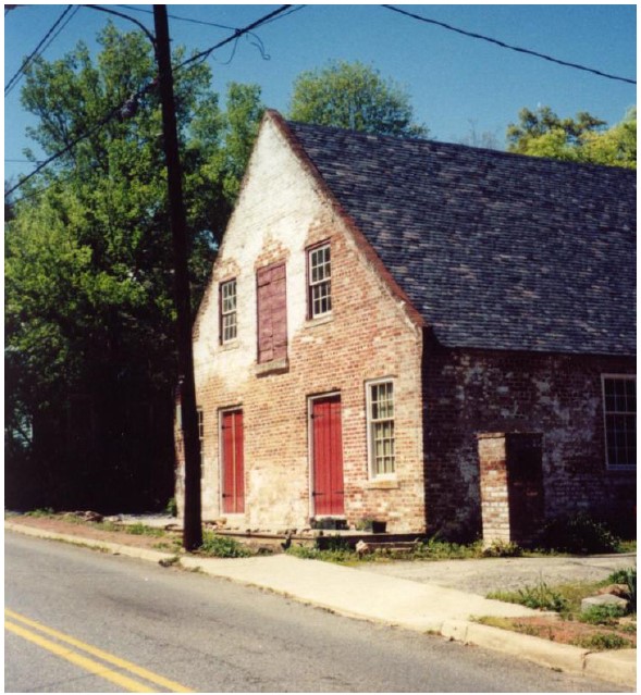
People stayed at Temperance Tavern (located on Washington Street in Falmouth) on their way west.
Bibliography:
- The William Allason Papers, State Library in Richmond, Virginia
- Darter, Oscar H. Colonial Fredericksburg and Neighborhood in Perspective. New York: Twayne Publishers, 1957.
#colonial #falmouth #gateway to west #William Allason # Rappahannock River #Port of Falmouth #Belle Plains #warrenton road #kings highway #Temperance Tavern