Impact of Highways in Stafford County
by Eric Powell
While modern highways are a 20th Century feature, transportation has always played an important role in Stafford’s History. Bordered by both the Potomac and the Rappahannock Rivers, the earliest highways were the rivers. The local tribes traveled these by canoe, trading with other tribes throughout the Chesapeake. When the English arrived, John Smith explored both rivers and made contact with indigenous people of the area[i]. It was the rivers that brought more settlers to the area and how agricultural and other products were transported to market. For most of Stafford’s history life centered along the water ways.
For traveling on land, the area of today’s U.S. Highway 1 began as an Indian path and eventually became a colonial road in 1664[ii], and was mostly used as a stagecoach road. Located on the Fall Line, halfway between Alexandria and Richmond, Falmouth and Fredericksburg became a stop for those traveling between the cities. Parts of what is today’s U.S. Highway 1 were improved to provide telegraph service through the area in the 1840s. Telegraph Road in North Stafford still bears the name. However, roads were not paved, and travel was extremely difficult in bad weather, so most cargo and passenger travel still centered along the rivers.
This began to change when the steam locomotive was invented in the early 1800s. The Richmond, Fredericksburg, and Potomac Railroad (RF&P) opened service from Richmond to Aquia Landing in 1842, providing rail service to Stafford. From there passengers and cargo would transfer back to the river to journey to points further north. The famous story of Henry “Box” Brown, the enslaved man who mailed himself from Richmond to Philadelphia seeking freedom, was partially on the RF&P.[iii] It is believed that it was at Aquia Landing that he was placed upside down when being transferred to the boat. The RF&P was a key factor in the Union’s decision base it operations in Stafford several times on its quest to capture the Confederate capital in Richmond. Supply for the Army of the Potomac was based at Aquia Landing. It wouldn’t be until after the Civil War that rail service would extend all the way to Washington DC and beyond. While the rivers continued to be an important highway, more and more travel shifted to the railroads leading into the 20th Century.
With the coming of the automobile, the demand for better roads increased. A State Highway Commission was established by the General Assembly in 1906, and in 1910 began registering and licensing motor vehicles to help pay for road improvements.[iv] The swampy areas of Stafford needed solid roads and improved bridges over numerous creeks, streams, and swamps. In 1916, President Woodrow Wilson signed the Federal Aid Road Act, providing federal funding to states to help improve roads used for mail delivery. The Virginia General Assembly approved the establishment of the first state highway system in 1918, which included the Richmond-Washington Highway as part of U.S. Highway 1, known today as Route 1 or just Richmond Highway in Stafford. Construction was interrupted by World War I, but picked back up during the 1920s. The Richmond-Washington Highway was officially dedicated and opened in 1927 at a ceremony in Fredericksburg. Governor Harry F. Byrd proclaimed, “Here in the City of Fredericksburg, half-way between Washington and Richmond, we stand on consecrated ground…uniting more closely two cities, formerly each a capital of a distinct government, which today flourish almost side by side under one flag.”[v] Warrenton Road, U.S. Highway 17 was also paved in the 1920s.
Once completed U.S. 1 opened up travel along the entire east coast from Florida to Maine. With increasing car ownership during the 1920s, travel began to shift away from the rivers and railroads. Development along Route 1 spurred new business-like restaurants, gas stations and motor inns. Some such places were the Aquia Tavern; the Hotel Virginia, now Aquia Realty near the courthouse; the Eskimo Diner and Clore’s Grill across from each other; and Browns Auto Court.[vi] Many of these boasted modern amenities, the best fried chicken and Virginia ham, and had gas pumps outside. The motor courts were often built as a cluster of cabins or cottages. Remnants of some of them, such as the Fox Chase Apartments and the El Patio Motel, are still seen in the county. A new courthouse was built in 1923 and the original Stafford High School, now the Alvin Y. Bandy Complex, opened in 1926.[vii] Cars also meant people could commute into Fredericksburg to work at the various factories and shop downtown.
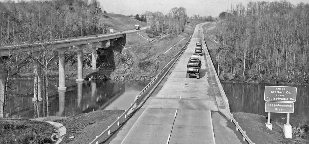
Route 1 was widened to four lanes coming in and out of Fredericksburg during the 1930s. Flooding on the Rappahannock River damaged the bridge in 1937 and again in 1942 while it was being reconstructed. It was at this time that the bridge was raised to its current height and Route 1 in Falmouth was changed to its current configuration.[viii] Route 1 originally travelled through the City of Fredericksburg following Princess Anne Street and Lafayette Boulevard, however, in 1946 the U.S. 1 Bypass was built so that traffic could move quicker around the city. This led to shopping centers, gas stations, and dealerships along the bypass and began to pull business away from downtown. The Park and Shop, now Eagle Village, opened in the 1960s with Montgomery Ward, moving from Caroline Street, as the anchor store, along with Giant Food and other stores.
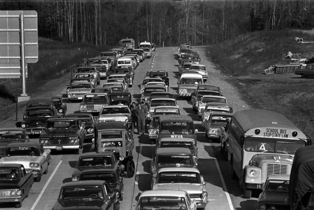
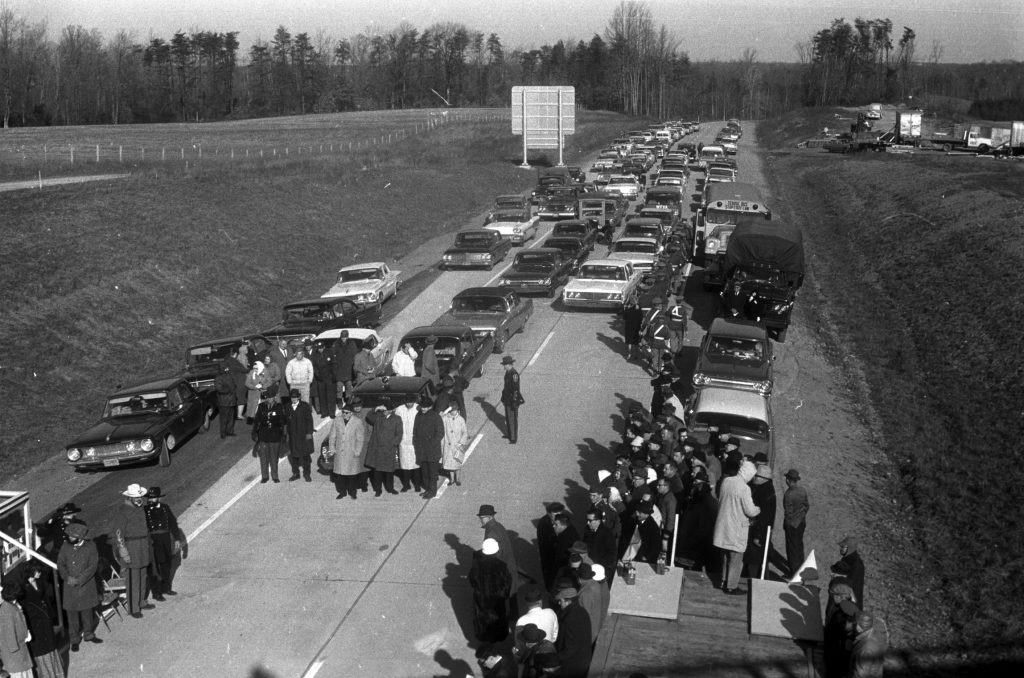
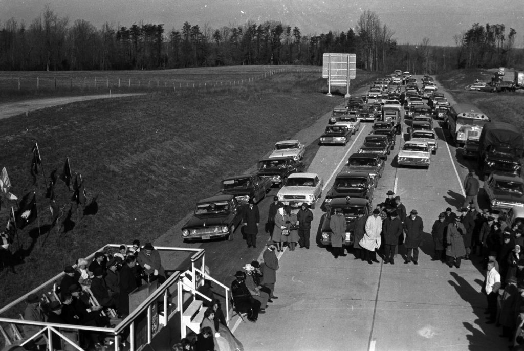
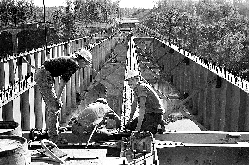
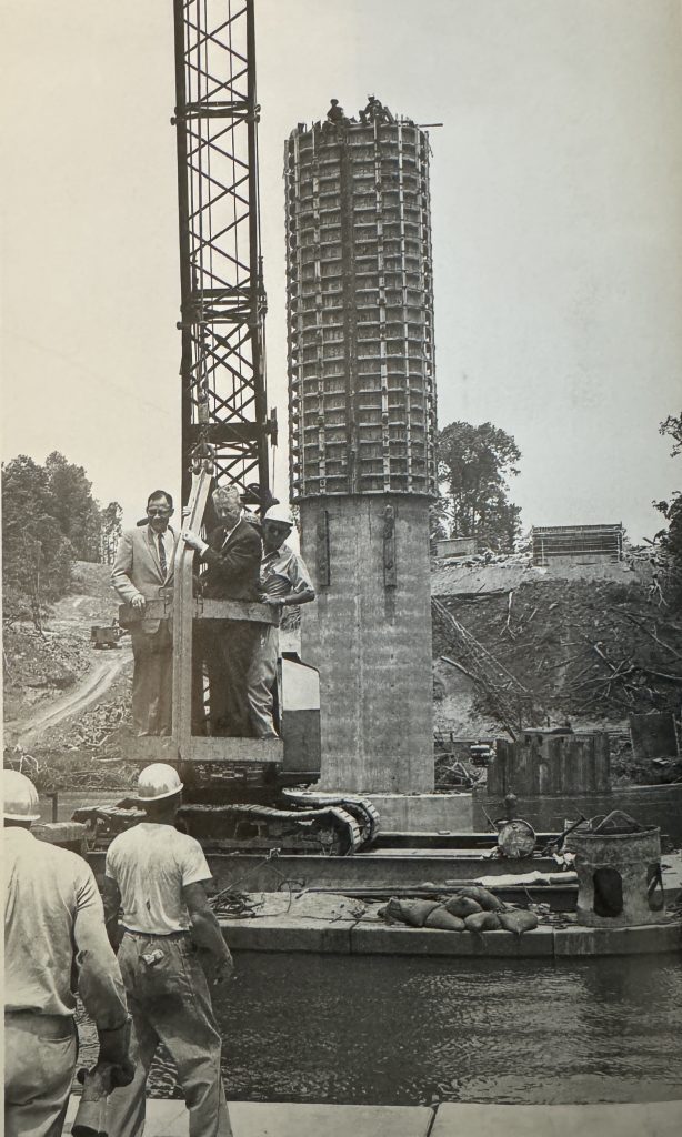
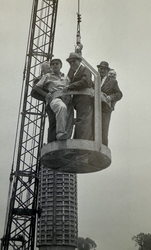
Following World War II, there was greater interest in building a national system of interstate highways. In 1956, Congress passed the Federal Aid Highway Act. This created the National System of Interstate and Defense Highways and was funded mostly by federal dollars. Virginia received 1,070 miles of interstate highway in this new system. The first sections of Interstate 95 (I95) in Virginia to open were between Woodbridge and Washington D.C. and from Richmond to Petersburg. I95 opened in between Massaponax and Dumfries in December 1964.[ix] The interchange at Aquia and Garrisonville changed this area and led to the destruction of several properties in the area, including the Aquia Tavern.
With the opening of I95, traffic and business continued to shift away from the river, downtown Fredericksburg, and the Route 1 corridor. The 1970s and 1980s saw an influx of people moving into Stafford County that could now commute north to the Quantico Marine Corps Base or to Washington D.C. or south to Richmond. Stafford’s population in 1970 was 24,789, had more than doubled by 1990 to 62,600, and reached 157,746 by 2020.[x] Development occurred along the interchange at Aquia and out Garrisonville Road. North Stafford grew very quickly and a new high school was opened in 1981.
The exits for U.S. Highway 17 in Stafford and Route 3 in Spotsylvania also saw development as more people moved into the area. The motor courts and restaurants were soon replaced by strip malls and chain restaurants. The Spotsylvania Mall, now the Spotsylvania Towne Center, opened in 1980 and department stores, like JCPenny, Montgomery Wards, and Sears that used to be located in the city moved out to the new location right off of the interstate.
Stafford County, and the greater Fredericksburg area continues to grow because of access to major highways. Geico located its offices on U.S. 17 in 1994 and Central Park was opened in 1995 on the old golf course of the Sheraton Hotel at the Route 3 exit. The Stafford Marketplace on Garrisonville Road opened in 2002. Stafford now has five high schools, with a sixth one on the way. Exit 136 for the Centerport Parkway was added to provide access to the Stafford Regional Airport when it opened in 2001[xi]. Commuter toll lanes have been recently added to I95 all the way down to the Route 17 exit to help ease the traffic congestion the area has come to be known for. Continued growth is expected for the foreseeable future. From river traffic to highway traffic, Stafford County has evolved and become one of the fastest growing areas in Virginia.[xii]


[i] Captain John Smith and the Early Citizens of the Tidewater Region, The Tidewater, Volume 2, Issue 8, April 1993. Accessed on 11/20/2023 from the Stafford Museum and Cultural Center,
[ii] From Indian Path to Highway, Historical Marker Database, Accessed 11/20/2023, https://www.hmdb.org/m.asp?m=2188.
[iii] Early Escape Route, The Trail to Freedom, Accessed 11/20/2023, https://www.hmdb.org/m.asp?m=40130.
[iv] Virginia Department of Transportation, A History of Roads in Virginia: “The Most Convenient Wayes”, October 2006, pp 23-34.
[v] Powell, Eric, It Smelled Like Money: Fredericksburg During the Great Depression (MA Thesis Virginia Commonwealth University, August 8, 2001) pp. 20-21.
[vi] Stafford Museum and Culture Center, Transportation – Motels and Restaurants, Accessed on 12/20/2023
[vii] Historic Resources Survey of Stafford County, Virginia, Tracceries, June 1992, Accessed on 12/19/2023, https://www.dhr.virginia.gov/pdf_files/SpecialCollections/ST-036_Historic_Resoiurces_Survey_Stafford_1992_TRACERIES_report.pdf.
[viii] Eby MacGregor, Jerrilyn, Falmouth Bridge, Gari Melchers Home and Studies, originally published in the Stafford County Historical Society Newsletter in March 2016, Accessed on 11/20/2023,
[ix] Virginia Highways Project, I-95, Accessed 11/20/2023, http://www.vahighways.com/route-log/i095.htm.
[x] Our Changing Population: Stafford County, Virginia, USA Facts, Accessed 12/19/2023, https://usafacts.org/data/topics/people-society/population-and-demographics/our-changing-population/state/virginia/county/stafford-county/?endDate=2022-01-01&startDate=1970-01-01.
[xi] Stafford Museum and Cultural Center, Stafford Airport, Accessed 1/2/2024
[xii] Glatz, Kyle, Americans Are Flocking to These 6 Fastest-Growing Counties in Virginia, November 19, 2023, Accessed 12/19/2023, https://a-z-animals.com/blog/americans-are-flocking-to-these-fastest-growing-counties-in-virginia/.

